Land Surveying of a Land Plot: What It Is and Why It's Needed
Important for Every Landowner
Due to changes in the law, the term "land surveying" is now heard by all landowners. It's useful for everyone to know about this procedure, even those who are planning to purchase land. We'll explain the benefits of land surveying and situations where it's unavoidable.
Land surveying is the process of establishing, restoring, and fixing the boundaries of a plot on-site, determining its area and location. Land surveying also includes the legal documentation of the obtained data.
Why is land surveying necessary?
Ability to Manage the Land Plot
As of 2018, a ban was introduced on conducting transactions with land plots without clarified boundaries. Now, it's impossible to manage an object without performing land surveying. Essentially, such lands fall out of circulation: selling, gifting, renting, exchanging, or making other transactions are only allowed with a plot whose boundaries have been established.
Resolving Land Disputes
Conflicts between owners of adjacent plots over their land boundaries are not rare. Conduct a land survey to prevent such land disputes from escalating into land wars.
During land surveying, you might encounter the issue of intersecting boundaries—i.e., overlapping land plots. This often occurs due to previous cadastral errors. We recommend resolving misunderstandings amicably. Otherwise, the issue is resolved in court (which risks being long and expensive).
Formation of Land Plots
The owner must conduct land surveying for all methods of forming land plots:
- division of a land plot (multiple plots are created from one);
- merging of land plots (one plot is formed from several adjacent ones);
- re-allocation of adjacent land plots (multiple new adjacent plots are created);
- allocation of a land plot (one or more plots are created when allocating a share or shares from a plot in shared ownership);
- formation of plots from land owned by the state or municipality.
Definition
State Real Estate Cadastre is a systematic collection of information on registered real estate, boundaries between subjects of the Russian Federation, municipal formations, populated areas, territorial zones, and other data. Its main purpose is to organize the circulation of rights to real estate.
What's Important: Information from the survey plan is entered into the State Real Estate Cadastre. You can independently check whether land surveying has been conducted for a specific land plot. To do this, go to the Rosreestr portal under the "Public Cadastral Map" section and enter the cadastral number or address of the plot in the search bar.
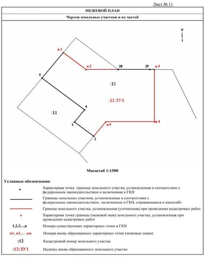
This is how the graphical part of a survey plan looks
How Is Land Surveying Conducted?
This procedure is carried out by a cadastral engineer who can work independently as an individual entrepreneur or be an employee of a geodetic organization. In any case, he must be registered in the registry of cadastral engineers — you can verify this here.
A contract is signed for the performance of cadastral works. The cadastral engineer visits the site to conduct geodetic surveying, measurements, fix points of coordinates, determine the area of the object, and agree on the boundaries with owners of adjacent plots.
As a result, the owner receives a survey plan in paper and electronic formats. Then, you need to visit the Rosreestr office where the survey data will be registered.
What's Important: We recommend conducting land surveying by uniting with neighbors (especially relevant for dacha plots). Why? Land surveying is an expensive service. Some geodetic organizations offer discounts when multiple people apply together. The savings can reach several thousand rubles.
Can Land Surveying Be Done for Free?
Yes, the law provides for such cases:
- When purchasing or renting a land plot located in state or municipal ownership through an auction. The surveying is paid for by the state or municipality.
- As part of comprehensive cadastral works. When, at the expense of the regional budget, surveying is conducted for large zones — cadastral blocks. Individually, all land plots within such a block are surveyed. This is done to reduce the area of unaccounted land, which allows increasing the tax base. But only until 2020.
What's Important: Owners of plots involved in comprehensive cadastral works are notified by the local government office, Rosreestr office, and the implementing organization. How? Information is published on their official websites, local government notice boards, in media, and where possible, letters are sent directly to the owners. Therefore, it's important to keep track of news in your region.
Need a renovation specialist?
Find verified professionals for any repair or construction job. Post your request and get offers from local experts.
You may also like
More articles:
 Stylish Interior for a Family with Two Children: Aiya Design Project
 The Perfect Kitchen Apron: 14 Ideas, 17 Examples
 How to Decorate Interior Without a Designer: 6 Useful Posts
 From One-Room to Two-Room: 8 Successful Renovation Projects
 How to Design a Comfortable Kitchen: 10 Important Rules
 What Apartment Work You Should Definitely Trust to Professionals
 "Healthy" Interior: 10 Materials to Avoid for Your Health
 What's in Style in 2018: 10 Major Design Trends